Udaweriya Mountain Sri Lanka
TRAVEL GUIDE

Bambarakanda
Falls

Sri Lanka’s tallest waterfall in the heart of the highlands.

SCROLL
THE ULTIMATE GUIDE

Where Water Meets the Highlands

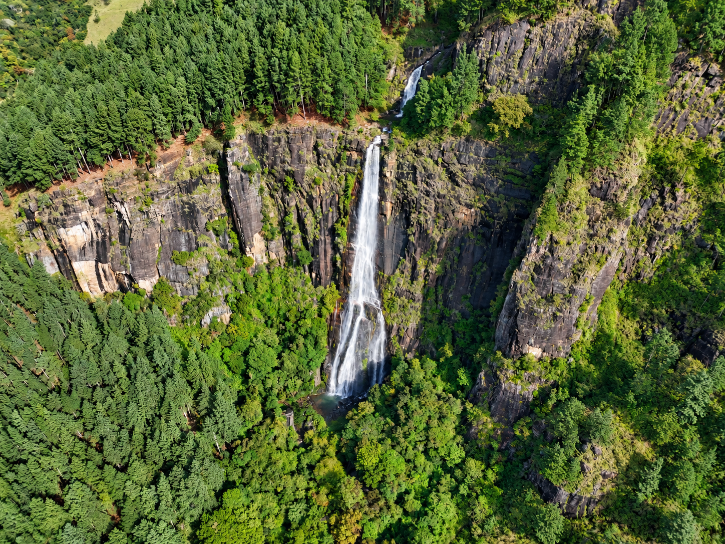
Bambarakanda Falls rises above the Kalupahana landscape as one of Sri Lanka’s most recognisable mountain landmarks.

At 263 metres, the waterfall is recognised as the tallest in Sri Lanka. It drops over a steep rock face surrounded by pine forest, changing cloud, mist and rugged highland scenery.

The journey is part of the experience. Narrow mountain roads, forested slopes and cool air gradually reveal the falls as you move deeper into the Bambarakanda landscape.

PLAN YOUR VISIT ↗
Bambarakanda Falls near Kalupahana Sri Lanka
BAMBARAKANDA FALLS Kalupahana highlands, Sri Lanka
BAMBARAKANDA IN DETAIL

Everything to Know Before You Visit

Bambarakanda is more than a viewpoint. The waterfall, the road from Kalupahana, the pine forest and the surrounding mountain trails form one connected highland experience. Use this guide to understand the landscape, access, conditions and what to expect on the ground.

HEIGHT
263 m
Sri Lanka’s tallest waterfall.
LOCATION
Kalupahana
Badulla District, Sri Lanka.
FROM A4
≈ 5 km
Mountain-road access from the highway.
WATER SOURCE
Kuda Oya
Part of the wider Walawe River system.
WEATHER & TIMING

Expect changing highland conditions

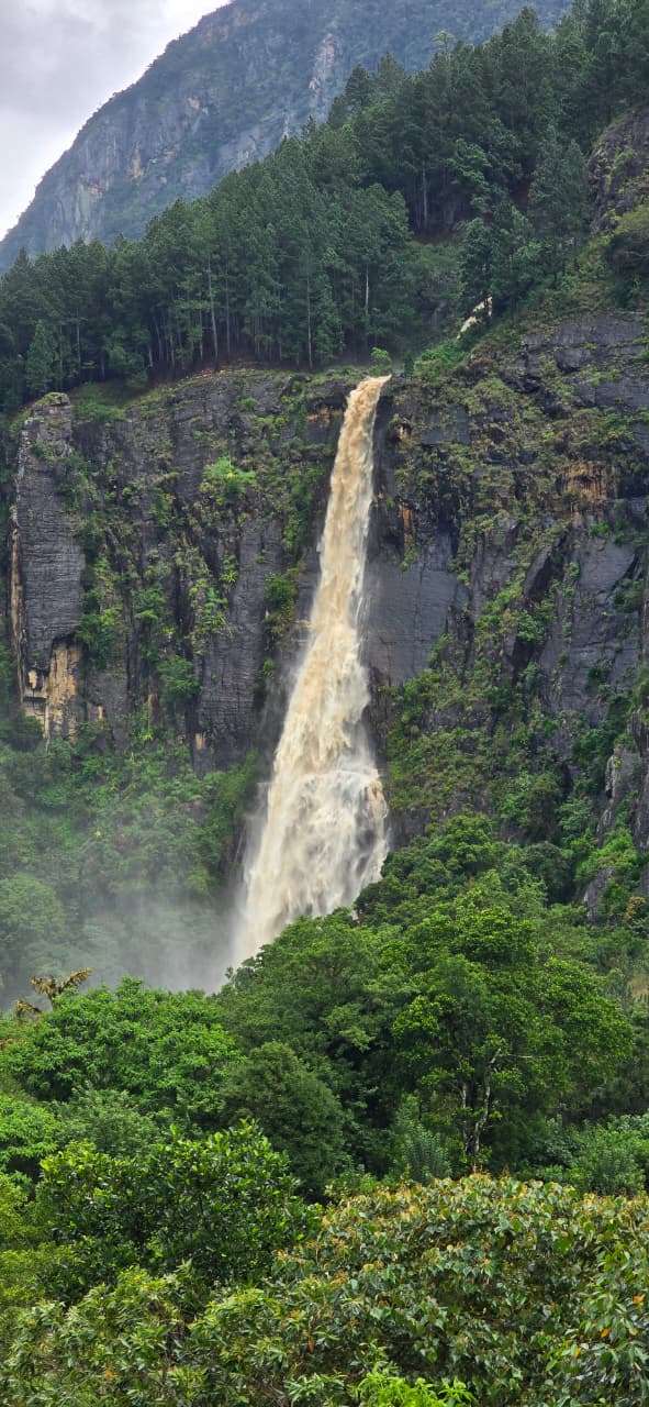
Bambarakanda’s appearance depends heavily on recent rainfall. After wetter periods the cascade can look stronger and more dramatic; during drier periods the flow may be thinner.

Visibility can also change within a short time as cloud and mist move across the mountains. Earlier visits can offer softer light and a quieter atmosphere, but highland weather can change quickly.

LIVE WEATHER

Bambarakanda

Updating conditions...
-- °C
Loading... Feels like --°
HUMIDITY --%
WIND -- km/h
RAINFALL -- mm
Kalupahana · Sri Lanka Highlands
LIGHT Morning & changing cloud

Softer morning light can work especially well around the falls.

FOOTING Can be wet & slippery

Take care on trails, rocks and uneven ground after rainfall.

FLOW Varies with recent rainfall

Stronger flow is more likely after periods of wetter weather.

Highland conditions can change quickly. Allow flexibility in your schedule and avoid rushing mountain roads when visibility is poor.

THE WATERFALL & LANDSCAPE

Why Bambarakanda feels different

Bambarakanda’s scale is easiest to understand from a distance. The 263-metre drop appears as a thin white line against a tall rock wall, with pine-covered slopes framing the view. Because the fall is narrow rather than wide, its appearance changes dramatically with rainfall, mist and light.

Sri Lanka Tourism describes the falls as being formed by Kuda Oya, a branch of the Walawe River. Water from the upper highlands reaches the cliff edge and drops almost vertically before continuing through the lower forested terrain.

The surrounding environment is part of Bambarakanda’s identity: steep terrain, pine forest, exposed rock, cool air and frequent cloud movement create a more rugged experience than a typical roadside waterfall stop.

GETTING THERE

From the A4 Highway to the falls

Bambarakanda Falls is located near Kalupahana and is listed by Sri Lanka Tourism at approximately 5 km from the A4 Highway. The turn-off leads into the mountains on a narrow road with bends, uneven sections and changing surface conditions.

Sri Lanka Tourism notes that the final road can be narrow, water-affected and potholed, and recommends a vehicle with good ground clearance for difficult conditions. It also notes that the journey from Kalupahana may take roughly 30–40 minutes depending on road conditions.

Road conditions can change.

Heavy rain, repairs and local traffic can affect access. Check current conditions locally before driving the final mountain section.

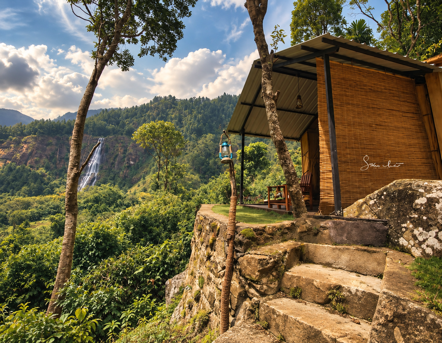
Eco Wild Glamping near Bambarakanda Falls
STAYING NEAR THE FALLS

Turn Bambarakanda
into part of the stay

Eco Wild Glamping Bambarakanda lists Bambarakanda Waterfall at approximately 400 metres from the property. Staying nearby means you can experience the area at a slower pace instead of treating it as a rushed stop between longer drives.

The property also lists nearby hiking, trekking and jeep experiences around the Bambarakanda highlands, including routes toward Lanka Ella, Devil’s Staircase, Wangedigala and the wider tea-country landscape.

VIEW ECO WILD ACCOMMODATION ↗
GOOD TO KNOW

Bambarakanda FAQ

Quick answers for planning a visit to Sri Lanka’s tallest waterfall and a stay nearby at Eco Wild Glamping.

Bambarakanda Falls is 263 metres high and is recognised as the tallest waterfall in Sri Lanka.

Bambarakanda Waterfall is located near Kalupahana in Sri Lanka’s central highlands, within the Badulla District.

Bambarakanda Falls is approximately 5 km from the A4 Highway. The final section follows a narrower mountain road from the Kalupahana area.

Eco Wild Glamping Bambarakanda lists the waterfall at approximately 400 metres from the property, making it possible to stay close to the surrounding highland landscape.

Comfortable walking shoes with good grip are recommended, together with drinking water and a light rain layer. Trails and rocks can become wet or slippery after rainfall.

Yes. Eco Wild Glamping Bambarakanda provides accommodation close to the falls, allowing guests to spend more time exploring the surrounding mountains, trails and waterfalls.

The final mountain road can be narrow, uneven and affected by rainfall. Conditions can change, so a vehicle with good ground clearance can be useful when the road is difficult.

Allow enough time for the mountain road, walking and changing weather conditions. The journey from the Kalupahana area can take around 30–40 minutes depending on road conditions, so avoiding a rushed schedule is recommended.